LUC
Interactive consultation with Trydan Gwyrdd Cymru
Interactive consultation with Trydan Gwyrdd Cymru
Details:
- Company: LUC
- Client: Trydan Gwyrdd Cymru
- Year: 2025 - 2028
- Region: Wales
- Product: Unreal Engine, ESRI, Cesium
Service areas:
- Community engagement
- Visualisation, 3D modelling and animations
- Digital twins
Introduction
LUC is supporting Trydan Gwyrdd Cymru by providing interactive 3D visualisation platforms for their initial suite of proposed onshore wind farms.
These models serve as a vital component of the community engagement programme, allowing stakeholders to explore proposals in high detail.
By bringing wind energy proposals to life, we help people understand exactly how these structures will appear within the landscape when viewed from familiar locations.
Challenges
Trydan Gwyrdd Cymru needed a way to help communities and stakeholders engage with wind energy proposals in an open and accessible way.
They required visuals that could model potential visibility from homes and local landmarks within an average 10-kilometre radius of each site.
The goal was to create a recognisable, relatable, and realistic visual experience that effectively communicated the impact of projects on the wider landscape.
Solutions
We developed advanced, real-time visualisation tools to meet these engagement goals:
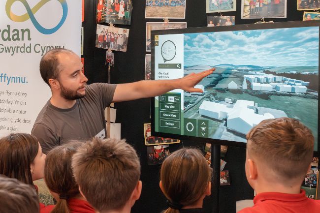
* Gaming technology platforms: We used gaming technology to create platforms that allow users to navigate each site freely in real-time.
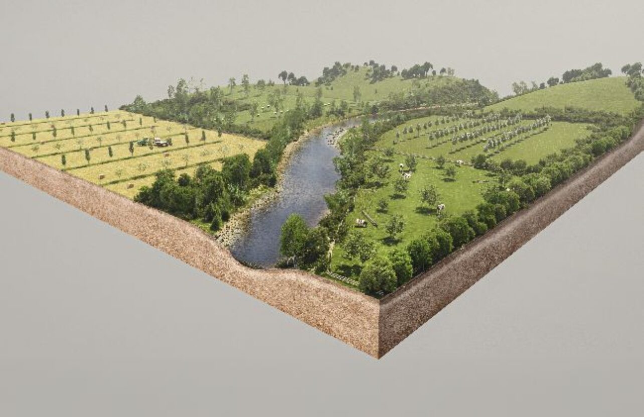
* Accurate data modelling: Each model integrates LiDAR terrain models, aerial imagery, the National Tree Map, and bespoke site layouts to reflect real-world conditions.
* Localised search tools: A postcode search function was implemented, enabling users to view the project from the specific places that matter most to them.
* Comprehensive digital suite: Beyond interactive models, we produced animations, still images, and virtual consultation rooms to ensure the project remained accessible online.
* Gaming technology platforms: We used gaming technology to create platforms that allow users to navigate each site freely in real-time.
* Accurate data modelling: Each model integrates LiDAR terrain models, aerial imagery, the National Tree Map, and bespoke site layouts to reflect real-world conditions.
* Localised search tools: A postcode search function was implemented, enabling users to view the project from the specific places that matter most to them.
* Comprehensive digital suite: Beyond interactive models, we produced animations, still images, and virtual consultation rooms to ensure the project remained accessible online.
Results
The interactive models for Glyn Cothi, Clocaenog Dau, and Carreg Wen serve as valuable presentation tools that strengthen the ability to communicate project value.
These platforms have already featured at public events, such as the Green Economy Conference in Swansea, helping different audiences understand the development process.
Beyond consultation, the models support internal briefings, communications work, and outreach activity.
They also serve as a foundation for ongoing project development, as the models are updated alongside the projects to reflect consultation feedback and site assessments.
The 3D digital model is an excellent tool for visualising projects within the landscape from various distances. It provides context on visibility and allows direct comparison with existing turbines. By making designs accessible to everyone, it helps us gather informed and specific feedback on our proposals.
Dr Catrin Ellis-Jones
Head of Public Involvement, Trydan Gwyrdd Cymru