LUC
Herefordshire Natural Environment Evidence
Herefordshire Natural Environment Evidence
Details:
- Company: LUC
- Client: Herefordshire Council
- Year: 2022 - 2024
- Region: England
Service areas:
- Geographical information systems (GIS) and mapping
Introduction
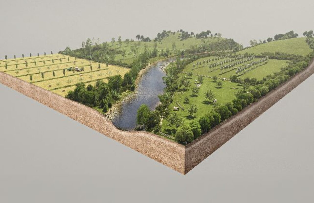
Commissioned by Herefordshire Council in June 2022, the Herefordshire Natural Environment Evidence project is a testament to LUC’s adept use of digital planning for guiding sustainable development. This multifaceted initiative incorporates key components including the Green and Blue Infrastructure Strategy, Landscape Character Assessment, Open Space Assessment, and detailed Habitat and Species analysis.
In tandem with LUC’s dedication to inclusivity, the project prioritises digital accessibility through use of our Digital Report platform. The commitment to creating a fully accessible website experience for all users, including those with disabilities, showcases how digital technology can improve public access to planning information.
In tandem with LUC’s dedication to inclusivity, the project prioritises digital accessibility through use of our Digital Report platform. The commitment to creating a fully accessible website experience for all users, including those with disabilities, showcases how digital technology can improve public access to planning information.
Challenges
It is estimated that around 15% of the world’s population has a disability. The 2018 Public Sector Accessibility Regulations require all public sector organisations to make their websites, and any documents hosted on them, accessible to at least WCAG 2.1 AA standard. To help our clients meet this standard, we began by creating accessible PDF reports and then progressed to developing fully digital online reports.
Local Plans are the foundation of planning decisions for a local authority; informed by a range of assessments and studies. Typically this comprises a suite of topic-based static pdf evidence reports. While there is range of supporting mapping in each, there is little opportunity to consider the spatial relationships between the topics.
Local Plans are the foundation of planning decisions for a local authority; informed by a range of assessments and studies. Typically this comprises a suite of topic-based static pdf evidence reports. While there is range of supporting mapping in each, there is little opportunity to consider the spatial relationships between the topics.
Solutions
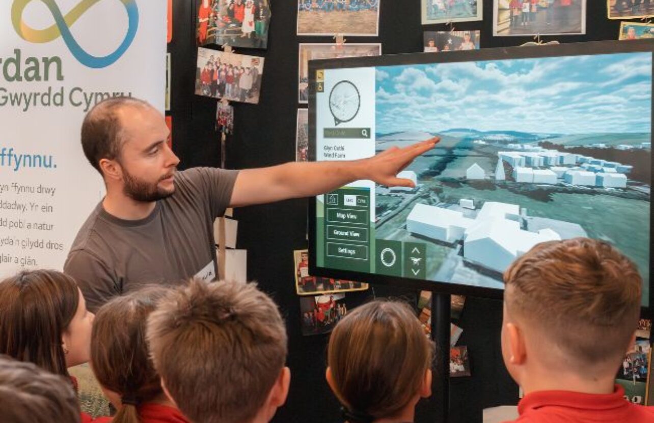
We saw the need to help our clients take the next step in their accessibility journey, and decided to develop our own fully digital HTML reports enriched with interactive elements such as tables, responsive charts and interactive maps. These online reports are particularly beneficial in terms of opening up access to local plan evidence reports to a much wider audience.
The interactive nature of the Herefordshire Environment map-based evidence helps planners in making informed decisions and allows the wider community to explore, and understand their local environment. The project transforms Local Plan evidence into a more usable resource for a broader range of stakeholders. Integrating evidence on the natural environment facilitates more holistic thinking. Where these studies would typically be commissioned and presented in isolation, the client had the foresight to think about this more holistically and LUC’s bespoke digital output supports this vision.
The interactive nature of the Herefordshire Environment map-based evidence helps planners in making informed decisions and allows the wider community to explore, and understand their local environment. The project transforms Local Plan evidence into a more usable resource for a broader range of stakeholders. Integrating evidence on the natural environment facilitates more holistic thinking. Where these studies would typically be commissioned and presented in isolation, the client had the foresight to think about this more holistically and LUC’s bespoke digital output supports this vision.
Results
LUC’s Herefordshire Natural Environment Evidence project stands as an example of the use of digital reports to support planning. The project goes beyond conventional mapping and reporting, demonstrating how digital technology can significantly improve the functioning of the local planning system. The commitment to digital accessibility and community engagement showcases how digital-based planning tools can widen public access while maintaining effectiveness. This project is an outstanding example of leveraging digital technology for transformative planning outcomes.
It was a pleasure working with knowledgeable and consummate professionals. The final result – GBI Strategy and associated web mapping of data, has been widely acclaimed and endorsed both internally and externally. LUC embraced our brief and thinking around an innovative ‘holistic’ approach and delivered the goods.
James Bisset
Herefordshire Council