Cadcorp
Beyond property to a deeper understanding of customer and neighbourhood
Beyond property to a deeper understanding of customer and neighbourhood
Details:
- Company: Cadcorp
- Client: Torus
- Year: 2023
- Region: England
- Product: Cadcorp SIS Desktop, Cadcorp SIS WebMap
Service areas:
- Geographical information systems (GIS) and mapping
- Plan-making, planning application and data management systems
- Organisational digital transformation
Introduction
Torus is one of the North West’s largest social landlords. Rooted in Liverpool, St Helens and Warrington – and active across 11 local authority areas – the Group manages 40,000 homes, serves 75,000 customers and employs some 1,500 staff.
An active developer of affordable homes for North West communities, Torus aims to build 5,600 new homes by 2026, a development programme worth in the region of £1bn.
Underpinning everything is the drive to create and grow stronger communities.
An active developer of affordable homes for North West communities, Torus aims to build 5,600 new homes by 2026, a development programme worth in the region of £1bn.
Underpinning everything is the drive to create and grow stronger communities.
Challenges
The drive for a stronger community required a deeper understanding of the challenges at neighbourhood level and where opportunities were presented to make the biggest positive difference.
Clear and compelling insights were needed to enable the Housing Management team to create fluid officer patches, Asset Management to prioritise stock improvements and Torus Foundation to target critical social interventions. Developments’ need was based not solely on the availability of land but on the promise of ‘place’.
Modelling required predictive analytics techniques and a GIS that could verify and showcase the research to a wide audience via web maps.
Solutions
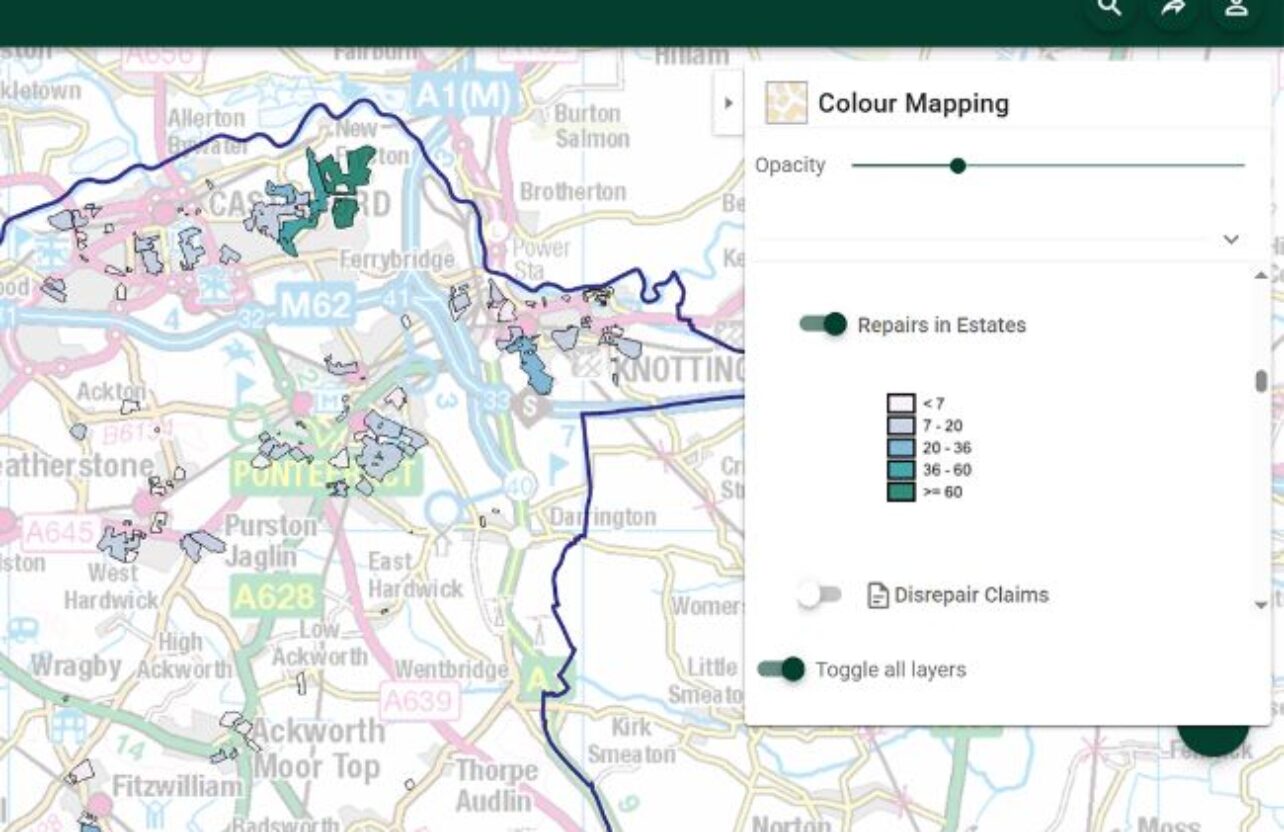
To eliminate the need for costly internal ICT infrastructure, Torus selected Cadcorp SIS Desktop and Cadcorp SIS WebMap in the cloud. Torus created a GIS SharePoint page where staff can access, amongst many others, thematic maps showing the locations of embedded assets, growth potential, and crime hotspots.
These maps were combined into an overall index of vitality. Local Knowledge™ provides context by presenting a breakdown of age groups, bedrooms, tenure, crime rates, unemployment, and a score on how a property is performing.
These maps were combined into an overall index of vitality. Local Knowledge™ provides context by presenting a breakdown of age groups, bedrooms, tenure, crime rates, unemployment, and a score on how a property is performing.
Results
Torus customers and staff can now access maps and information easily via the internet. The ease of managing SIS WebMap has encouraged non-technical staff to progress their own projects, freeing up GIS technicians to concentrate on more complex work.
Future projects, including the understanding of ‘place’ before and during investment, the propensity for properties and tenants to fall into risk, customer segmentation, and the profiling of new neighbourhood patches, will rely on the powerful spatial insights of GIS.
Future projects, including the understanding of ‘place’ before and during investment, the propensity for properties and tenants to fall into risk, customer segmentation, and the profiling of new neighbourhood patches, will rely on the powerful spatial insights of GIS.
“Cadcorp demonstrated an understanding of our values and the capacity to work with us to provide a quality, consistent service, and deliver GIS software and web mapping that meets the needs of our organisation.”
David Gerwitz
Asset Planning and Data Manager, Torus