Details:
- Company: PLACE LOGIC
- Client: Cherwell District Council and Oxfordshire County Council
- Year: 2025
- Region: England
Service areas:
- Geographical information systems (GIS) and mapping
- Planning and urban design services
Introduction
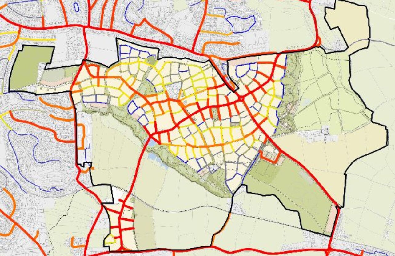
Representatives of the Cherwell District Council and Oxfordshire County Council asked us to undertake a comprehensive analysis of the street network connectivity and walkability across Banbury and its immediate surroundings. The study aimed to provide a detailed understanding of the structure of regional main routes and identify potential hotspots of activity. Additionally, the analysis focused on assessing existing levels of accessibility to everyday uses, the quality of the built environment, and the overall walkability potential of streets.
Challenges
While the study did not encounter significant technical constraints, it presented the broader challenge of applying advanced geospatial analysis to a historically evolved urban environment. Banbury’s complex spatial structure - shaped by centuries of incremental growth - required approaches capable of capturing both its traditional core and modern extensions within a unified framework. The use of our analysis enabled a deeper understanding of how the town’s historical development continues to influence present-day connectivity, accessibility, and walkability. This approach provides valuable evidence to support the Council’s future strategies for sustainable growth, active travel, and town centre revitalisation.
Solutions
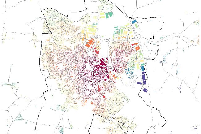
We employed our integrated suite of spatial analysis methods to provide a detailed and evidence-based understanding of Banbury’s street network and walkability. The approach combined network analysis, accessibility modelling, and urban form assessment to capture the functional and spatial dynamics of the town. Network analysis was used to evaluate the structure and connectivity of streets, identifying key routes and local movement patterns. Accessibility modelling assessed proximity to everyday destinations, helping to highlight areas with limited access to amenities. Urban form analysis examined street quality and built environment characteristics that influence the pedestrian experience. Together, these methods produced a series of thematic maps and spatial outputs that informed clear conclusions and actionable recommendations to support the Council’s future planning and movement strategies.
Results
Our analysis showed that Banbury’s street network has strong connectivity at its historic centre, reflecting its regional importance. High place connectivity also occurs in neighbourhoods such as Hardwick West, Grimsbury, and Ruscote, where dense, well-connected streets support local movement. The town centre is complemented by neighbourhood centres in Grimsbury, Hardwick West, Ruscote, Calthorpe South, and Bodicote, generally accessible and linked to local amenities. However, some centres lie on secondary streets with lower connectivity, limiting access for residents. High-quality urban form is limited, as 20th-century expansions feature either Garden City-style grids or cul-de-sacs, both less walkable. The most walkable areas include the historic centre, Neithrop South, and parts of Grimsbury, where better street design and clustered amenities encourage pedestrian activity. Findings were summarised in a report combining maps, graphics, and explanatory text for Cherwell District Council and Oxfordshire County Council.