PLACE LOGIC
Nansledan, Newquay (Newquay Growth Area)
Nansledan, Newquay (Newquay Growth Area)
Details:
- Company: PLACE LOGIC
- Client: The Duchy of Cornwall
- Year: 2013 - 2045
- Region: England
Service areas:
- Planning and urban design services
Introduction
Nansledan is a 218-hectare mixed-use, mixed-tenure, sustainable urban extension to the town of Newquay. The masterplan sets out a strategic and coordinated growth pattern for Newquay, eventually providing 3,750 new homes, 3,750 jobs, a new high street, primary school, GP surgery, and a variety of other public spaces and facilities. As a walkable community arranged around local centres, residents of Nansledan can meet their daily needs on foot, while also having strong physical connections with Newquay.
Challenges
In 2004, Cornwall Council sought to look beyond the traditional five year housing allocation, and strategically plan the town’s growth over the next half century. The vision sought to ensure development was delivered in an exemplary well-connected, mixed-use, and sustainable manner that would help to regenerate the local economy.
The town’s existing north-south street pattern was restricted by several level crossings across the railway, causing both network congestion and safety concerns. One of the primary objectives was to provide a new north-south bridge over the railway which would alleviate congestion, provide a new primary route east to the expanding Newquay Airport, and enable the dangerous level crossings to be closed.
Another objective was to plan the development around a string of local centres ensuring that all residents would be within a five minute walk of local services, and a 15-minute walk of the proposed high street.
Solutions
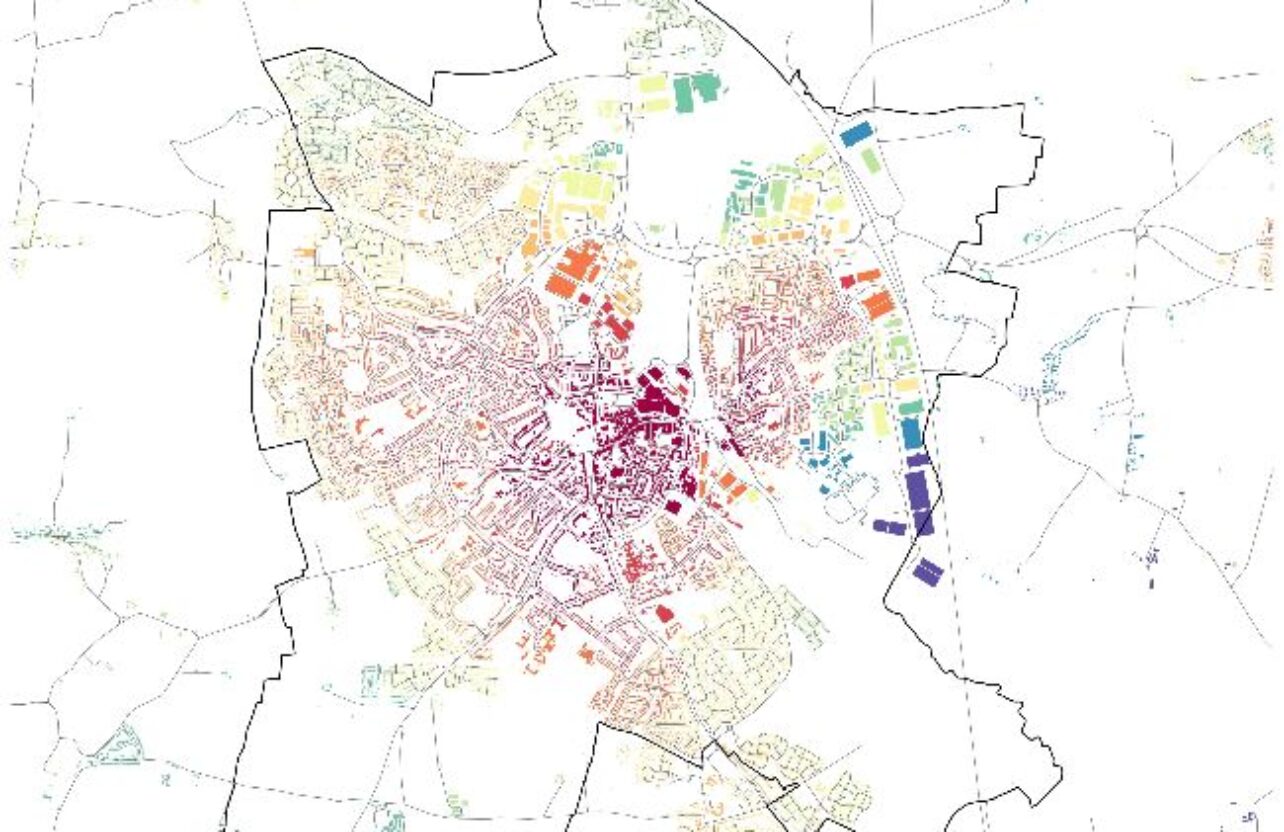
Utilising geospatial data analysis techniques, PLACE LOGIC assessed the local centre locations to ensure they were well distributed and located along higher order streets. Moreover, we considered how the introduction of new streets across the site and the closure of existing level crossings would affect the wider movement network in Newquay for all travel modes. We identified solutions that minimised congestion across Newquay and maximised the collateral benefits to both Nansledan and the whole Newquay area.
Results
The analysis identified primary and secondary networks which informed the location of mixed-use local centres and the new high street in areas that were highly-connected and therefore having the highest potential for passing trade. The resulting masterplan also optimised connections to the existing network, improving links to the town centre, the airport and the surrounding area. The new high street is located at the intersection of the two new primary routes.