Spatial Design Hub
- Founded: 2015
- 07719747821
- james@spatialdesignhub.com
- Visualisation, 3D modelling and animations
- Geographical information systems (GIS) and mapping
- Planning and urban design services
- Artificial intelligence (AI) and software solutions
- Artificial Intelligence (AI)
- Machine Learning
- Real-Time Streaming
- Satellite Imagery
- Customisable Dashboards
- Mobile applications
- Training and support
Introduction
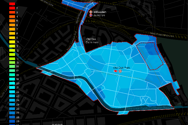
Our expertise in GIS and mapping enables planners, local authorities, and developers to analyse transport accessibility, connectivity, and spatial data effectively. Through our Urban Access web application, we offer detailed insights into public transport accessibility, liveability patterns, and spatial dynamics to support policy evaluations and strategic planning.
We develop AI-powered tools that automate data analysis, helping planning teams gain deeper insights into urban mobility, land use, and development feasibility. Our cloud-based solutions ensure seamless data integration and accessibility across projects, enabling better collaboration and decision-making.
Our visualisation and 3D modelling services support architects and urban designers in exploring spatial relationships, infrastructure scenarios, and future development potential. By integrating demographic data, transport networks, and urban form, we create interactive planning environments that enhance project engagement and communication.
We have successfully worked with local authorities, Network Rail, and leading planning consultancies, helping translate complex datasets into actionable insights that drive sustainable, connected, and accessible developments.
By combining geospatial expertise, digital innovation, and planning knowledge, Spatial Design Hub empowers stakeholders with the tools needed to create smarter, data-driven urban environments that support future growth and accessibility.
Our products
-
 Urban Access
Urban Access is a geospatial tool that analyses public transport accessibility, connectivity, and mobility patterns. It provides PTAL analysis, population density insights, and transport network mapping, helping planners and developers identify gaps and opportunities. Designed for data-driven decision-making, it supports sustainable, accessible, and well-connected urban development.
-
 Micromobility Planner
Micromobility Planner is an online tool that provides local authorities with data-driven insights to plan shared micromobility schemes. It offers analyses of ridership potential, decarbonisation impact, demographic data, and optimal parking locations, enabling informed decisions to enhance sustainable urban transport.
-
 Rail Insights
Rail Insights is an interactive analytics platform developed for Network Rail to provide insights into travel demand, station usage, and passenger crowding across the Great Britain rail network. It helps operators, planners, and policymakers make informed decisions to optimise operations, improve connectivity, and enhance the passenger experience.
-
 Spatial IQ
Spatial IQ is a customisable data platform that makes complex geospatial data easy to understand, explore, share and analyse. It is designed as a modular web-based platform with strong mapping and analytics capabilities, integrating third-party routing and modelling engines, and tailored for clients such as Network Rail.