Cross Works
A change management tool for one of the world's largest new city masterplans
A change management tool for one of the world's largest new city masterplans
Details:
- Company: Cross Works
- Client: Confidential (a major new city development, under NDA)
- Year: 2023 - 2024
- Region: Global
Service areas:
- Geographical information systems (GIS) and mapping
- Plan-making, planning application and data management systems
- Organisational digital transformation
Introduction
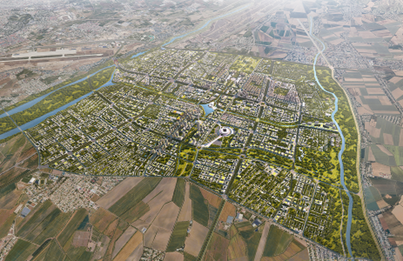
For the masterplan of one of the world’s largest new city developments, Cross Works established a digital platform to track, record and delegate design changes. On this complex, evolving masterplan with many design teams, a bespoke Change Management Tool integrates proposed changes into one live map. As a workflow process, teams submit changes as geographic data, alerting reviewers to assess them in place against existing masterplan layers—either approving and incorporating them into the masterplan, or rejecting and delegating back to the design team. The result is one governed, traceable source of truth for how the masterplan evolves.
Challenges
On a development of this scale, the masterplan is shaped by multiple teams working simultaneously, each responsible for a specific precinct or district. Proposed changes were shared through emails, drawings and file exchanges, resulting in fragmented communication, no single source of truth, and limited visibility of what had been reviewed or approved. This created the risk of overlapping or conflicting changes, while reviewers often lacked the spatial context to understand how a proposal would affect adjacent areas.
The challenge was compounded because the underlying geometry was stored in specialist GIS formats inaccessible to most stakeholders, effectively excluding the planners, designers and decision-makers who needed to respond to each change. Decisions were also difficult to trace, so accountability for how the masterplan had evolved was easily lost. Delivered over many years across numerous teams, this fragmentation posed a real risk to design coherence, coordination and timely delivery.
The challenge was compounded because the underlying geometry was stored in specialist GIS formats inaccessible to most stakeholders, effectively excluding the planners, designers and decision-makers who needed to respond to each change. Decisions were also difficult to trace, so accountability for how the masterplan had evolved was easily lost. Delivered over many years across numerous teams, this fragmentation posed a real risk to design coherence, coordination and timely delivery.
Solutions
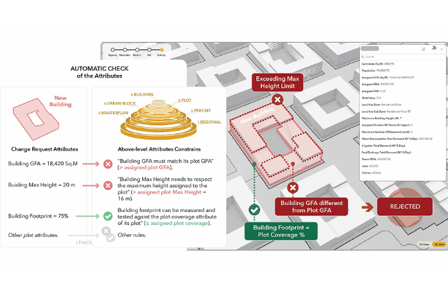
Cross Works developed a web-based platform that presents the live masterplan through an interactive map, underpinned by a structured review and approval workflow. Initiators submit proposed changes by uploading the underlying spatial geometry, including shapefiles, with any supporting documentation. The platform automatically processes the geometry, positions it within the project's coordinate system, and visualises it in both 2D and 3D, so stakeholders can see precisely what is proposed and how it relates to the wider development.
Submitted changes are routed to the appropriate reviewers, who assess them directly in their spatial context and approve or reject them as required. A role-based access model gives initiators, reviewers and administrators only the functions relevant to their responsibilities, while automated notifications maintain momentum and a comprehensive audit trail records every action and decision. As a result, the masterplan can only be updated through a controlled, transparent and fully accountable process.
Submitted changes are routed to the appropriate reviewers, who assess them directly in their spatial context and approve or reject them as required. A role-based access model gives initiators, reviewers and administrators only the functions relevant to their responsibilities, while automated notifications maintain momentum and a comprehensive audit trail records every action and decision. As a result, the masterplan can only be updated through a controlled, transparent and fully accountable process.
Results
The platform transformed a fragmented process of emails, file exchanges and drawings into a single, authoritative environment where proposed masterplan changes are submitted, visualised, reviewed and approved. Stakeholders without GIS expertise can understand and comment on spatial changes directly, eliminating specialist software and reducing delays from coordination and interpretation.
By bringing spatial geometry, supporting documentation and decision records together in one system, the platform creates a traceable history of how the masterplan has evolved. This transparency and accountability is vital for large-scale developments delivered over many years, involving numerous teams, disciplines and decision-makers.
For Cross Works, the project demonstrated how expertise in planning and designing complex urban environments can be translated into digital tools that support ongoing governance and delivery. Rather than letting spatial data, approvals and decisions fragment across systems and inboxes, the platform unifies them in a single coherent workflow, improving visibility, control and collaboration across the programme.
By bringing spatial geometry, supporting documentation and decision records together in one system, the platform creates a traceable history of how the masterplan has evolved. This transparency and accountability is vital for large-scale developments delivered over many years, involving numerous teams, disciplines and decision-makers.
For Cross Works, the project demonstrated how expertise in planning and designing complex urban environments can be translated into digital tools that support ongoing governance and delivery. Rather than letting spatial data, approvals and decisions fragment across systems and inboxes, the platform unifies them in a single coherent workflow, improving visibility, control and collaboration across the programme.