British Geological Survey
Lower Thames Crossing - 3D Geological Services
Lower Thames Crossing - 3D Geological Services
Details:
- Company: British Geological Survey
- Client: LTC-Cascade
- Year: 2018 - 2021
- Region: England
Service areas:
- Visualisation, 3D modelling and animations
- Geographical information systems (GIS) and mapping
- Environmental and sustainability services
Introduction
The Lower Thames Crossing project is a project worth up to £9 billion* commissioned by National Highways, which includes the development of 23 km of motorway connecting the M2/A2, A13 and M25, including two 4 km tunnels (each will be 16.4 m diameter) in the area of the Thames Estuary.
Challenges
The variable geology and wide spatial extent of the Lower Thames Crossing scheme pose multiple geotechnical challenges. Accurately predicting ground conditions is critical for managing these issues and for optimising the design of the scheme.
Solutions
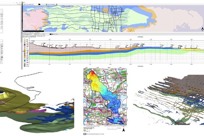
Working alongside partner geotechnical organisations, BGS provided a bespoke 3D ground model to characterise the ground and identify risks, - this included the synthesis of existing datasets with data collected by specialist BGS staff via Laser scanning, geological logging, shallow geophysical surveying, virtual outcrop model analysis and 3D geological modelling.
Results
The data and knowledge provided by the BGS augmented the intrusive ground investigation, increasing the confidence of predicting the likely ground conditions for the tunnel and transport infrastructure. It meant that ground investigation resources could be focused in areas with pressing geotechnical challenges, therefore maximising the cost benefit.