Lichfields
- Founded: 1962
- Community engagement
- Visualisation, 3D modelling and animations
- Geographical information systems (GIS) and mapping
- Environmental and sustainability services
- Plan-making, planning application and data management systems
Introduction
Our approach is evidence and data-driven. We have developed in-house framework tools that we apply to projects nationwide, applying our insights and research to sector-specific products.
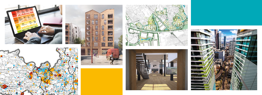
GIS and Spatial Analytics
The insight and analytical skills of Lichfields GIS and Spatial Analytical team helps clients understand the dynamics of people, places and business. The work informs commercial decision-making and policy formulation at all levels. Services include: data visualisation; catchment area mapping; interactive mapping; thematic ‘heat’ maps; spatial analysis; and visibility analysis.
Digital consultation
Lichfields offers the full range of digital, virtual and more traditional forms of consultation, which are integrated with our planning service. We can mobilise quickly. Focussing on the issues that matter most to our clients and the communities where they work. We create websites that take the audience on a journey through the project, enabling an interactive community engagement experience.
Economics
Our Economics team regularly supports landowners and developers in the promotion of strategic developments. We harness the power of data to help shape strategy and policy development, forecast growth and development needs, assess land use requirements, and test the feasibility and economic benefits of investment, and present evidence to public inquiries and examinations.
Our products
-
 Evaluate: making the economic case for development and measuring economic impact
Evaluate strengthens the economic justification for a development strategy or individual project by considering the full range of local benefits. Our analysis draws on the latest data and best practice and guidance, we use graphics tools to present analysis in a visual way, through user-friendly infographics.
-
 Affordable: Making the case for affordable housing and its wider benefits
Affordable provides an authoritative mechanism to identify the need for, and benefits of, affordable housing delivery. It is a data-led approach that strengthens the justification for a development strategy or individual project by considering the full range of local factors and benefits associated with the delivery of affordable housing.
-
 Bedspace – assessing the need for Purpose Built Student Accommodation
Bedspace helps clients demonstrate the need for PBSA through an evidence-led quantitative analysis of current and past trends in student growth. Demonstrating the current supply pipeline and growth strategies of the relevant institutions to identify capacity for further PBSA in any defined location.
-
 Carepacity – making the case for care, retirement and sheltered housing
Carepacity helps developers assess the potential for older people’s housing and presents the best possible case for development. It offers a package of tools that assesses the potential and then demonstrates the case for development by; Evaluating the need; Quantifying the benefits and impacts; and Enabling delivery.
-
 Healthier – data-driven planning for assessing health impacts
Healthier integrates various UK guidance methodologies for Heath Impact Assessments into a comprehensive framework. Paired with Lichfields’ expertise in planning, economics, community engagement and GIS analysis, it offers a holistic assessment of health impacts arising from new developments.
-
 Locate:Solar – finding and developing suitable sites for ground-mounted solar farms
Locate: Solar brings together technical data on capacity and yield, GIS-mapped environmental information and our in-depth understanding of the planning system. From this, we undertake constraints and viability analysis for use in; initial site finding exercises at feasibility stage; and preparing Alternative Site Assessments at planning application stage.
Bringing innovation to every project.