Space Syntax
Cardiff Central Station | Pedestrian movement analysis
Cardiff Central Station | Pedestrian movement analysis
Details:
- Company: Space Syntax
- Client: Network Rail
- Year: 2015
- Region: Wales
Service areas:
- Planning and urban design services
- Plan-making, planning application and data management systems
Introduction
Construction of a Pedestrian Movement Forecast Model to evaluate design options for the comprehensive redevelopment of the station & its surroundings.
The Cardiff Central Masterplan represents an opportunity for Cardiff and the surrounding region to raise the profile of the area both within the UK and internationally. The masterplan includes the BBC project with a Central Square to the north of the station, a new Arena and public sector offices to the south and a new public route through the Central Station.
The Cardiff Central Masterplan represents an opportunity for Cardiff and the surrounding region to raise the profile of the area both within the UK and internationally. The masterplan includes the BBC project with a Central Square to the north of the station, a new Arena and public sector offices to the south and a new public route through the Central Station.
Challenges
Cardiff Central Station is the main gateway to Cardiff. The local context of the station is currently constrained by the largely vehicle oriented road infrastructure, the railway infrastructure and the poor quality of the public realm.
In order to assess the impact on pedestrian movement patterns of the station masterplan and the future developments around it, Network Rail commissioned Space Syntax to develop a Predictive Movement Model and Forecast.
In order to assess the impact on pedestrian movement patterns of the station masterplan and the future developments around it, Network Rail commissioned Space Syntax to develop a Predictive Movement Model and Forecast.
Solutions
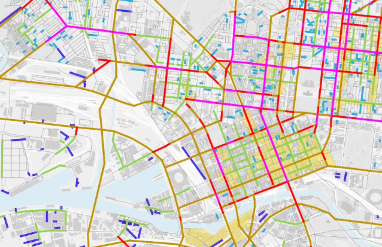
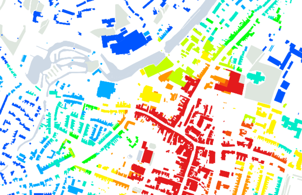
One of the key inputs of the Space Syntax approach is to provide a contextual understanding of a site in terms of its connectivity and multi-modal movement potentials.
A Spatial Accessibility Model of the existing pedestrian movement network of Cardiff was constructed to identify a set of opportunities and constraints for the site.
During the design development process, this model was used as a design tool to test the impact of spatial layout changes as a result of the emerging design options. This informed the design development and influenced strategic decisions by enabling an objective evaluation of proposed scenarios in terms of their likely impacts on movement patterns and activity potentials.
Results
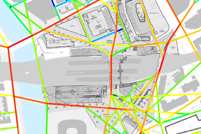
Combining land use, population and transport data, a Spatial Accessibility Model was created and used as the base for a Predictive Movement Model. This model was then used to translate future changes in layout, quantum of development and station demand uplift into a Pedestrian Movement Forecast for the preferred masterplan option and its immediate context.
The Spatial Accessibility Analysis highlighted the potential of the proposed public route to create a well-used north-south connection that would contribute to the overall improvement of connectivity in the area. This potential was then validated by running the Pedestrian Movement Forecast for the future scenario.
The Spatial Accessibility Analysis highlighted the potential of the proposed public route to create a well-used north-south connection that would contribute to the overall improvement of connectivity in the area. This potential was then validated by running the Pedestrian Movement Forecast for the future scenario.