British Geological Survey
City of London’s Climate Action Strategy – The Cubic Mile
City of London’s Climate Action Strategy – The Cubic Mile
Details:
- Company: British Geological Survey
- Client: City of London Corporation
- Year: 2021 - 2022
- Region: England
Service areas:
- Geographical information systems (GIS) and mapping
- Environmental and sustainability services
- Plan-making, planning application and data management systems
Introduction
The City of London Corporation partnered with the British Geological Survey, under the UK Climate Resilience Programme Embedded Researcher scheme, to evaluate the extent to which the ground beneath the City of London (the subsurface space) could be better utilised to support their climate resilience and adaptation measures.
Challenges
The City of London is one of the UK’s most densely built and economically vital urban areas. Specific modelling carried out by the Met Office (UKCP18) for ‘The City’ of London indicates that overall winters will be 20% wetter and summers 30% drier with more extreme weather events and sea level rise. Increased rainfall and surface water run-off present an issue for The City, where the presence of hard surfaces will significantly increase the risk of flooding of high-profile commercial premises. The projected increase in intensity and frequency of high temperatures and heatwaves will also lead to increased mortality and issues of overheating for The City’s people and services.
More information about subsurface space in the City of London was needed to understand how it could help deliver the City of London Corporation’s Climate Action Strategy 2020-2027.
More information about subsurface space in the City of London was needed to understand how it could help deliver the City of London Corporation’s Climate Action Strategy 2020-2027.
Solutions
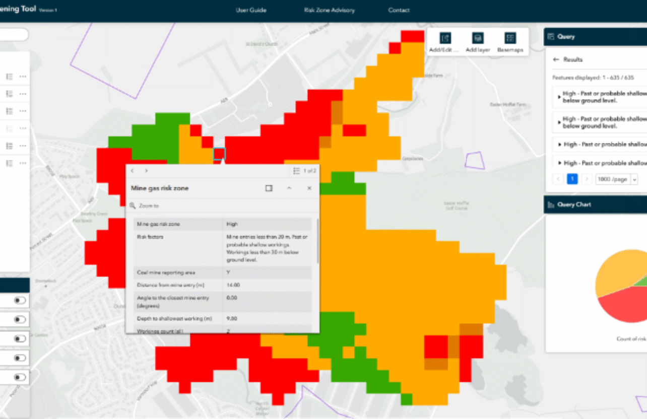
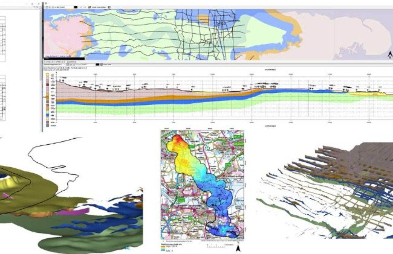
• A GIS-based shared data-model was created which brought together available subsurface datasets for the City of London for the first time, allowing the City to begin to scope locations for new climate adaption measures such as tree planting.
• A data and policy review was undertaken to scope options for five climate adaptions measures: urban greening and tree planting; sustainable drainage options; ground source heating and cooling technologies; cool spaces underground, and; climate risks to buried assets.
• Interviews and workshops were facilitated to promote cross learning, creating a platform for surface-subsurface knowledge exchange.
Results
• Findings have been used to support the City’s Cool Streets and Greening programme, identifying congestion below ground and improving success rate in identifying suitable locations for tree planting.
• The Data and Policy review revealed how buried utilities, geology, and existing infrastructure could limit or enable climate resilience measures like sustainable drainage systems (SuDS) and ground source energy.
• The outputs were cited as a UK case study in the Government Office for Science – Future of the Subsurface Foresight report, demonstrating how subsurface mapping and climate adaptation planning in a dense urban area can inform national strategies.
- Highly commended in the London Tree and Woodland Awards 2023