British Geological Survey
- Founded: 1835
- 0115 9363143
- British Geological Survey, Keyworth, Nottingham, NG12 5GG, UK
- enquiries@bgs.ac.uk
- Visualisation, 3D modelling and animations
- Geographical information systems (GIS) and mapping
- Planning and urban design services
- Land search and assessment
- Digital twins
- Machine Learning
- Satellite Imagery
Introduction
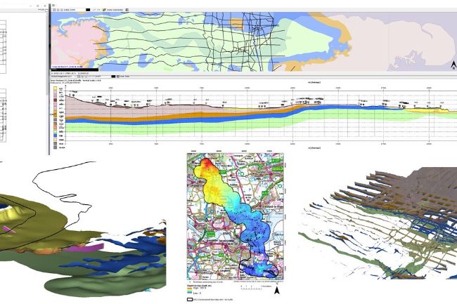
Our expertise is used to inform the spatial planning system on a range of topics including natural hazards (e.g. subsidence, landslides, seismicity), groundwater, mineral resources, brownfield regeneration, space weather, the seabed, geothermal energy and energy storage. Our knowledge and expertise supports effective decision making at all stages of the planning and development process particularly in relation to geological hazards and natural resources. We also offer extensive experience and expertise in support of Nationally Significant Infrastructure projects such as transport infrastructure, pumped storage schemes and geological disposal.
Our products
-
 GeoIndex web tool
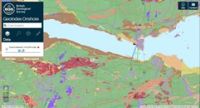
BGS GeoIndex is a web tool to access BGS data. The map viewer is free to use and is designed to work on desktop and mobile devices.
-
 BGS information products and services for planning
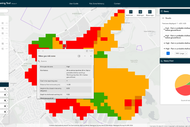
A range of datasets and services are available that are of direct relevance as part of the planning process, including information on natural hazards, mining hazards, groundwater, SuDs, Ground Source Heat Pumps, building stones and mineral resources.
-
 BGS Geohazard information products
A range of geospatial information products are available that cover a range of geohazard and related themes, including our BGS GeoSure hazard susceptibility product through to climate scenario-based offerings.
-
 BGS Georeports
GeoReports provide cost-effective access to unique sources of published and unpublished geological data, combined with expert advice from BGS scientists. These reports provide information on ground conditions for land redevelopment and conveyancing, including Radon potential, Subsidence assessment, GSHP assessment, Infiltration SuDS suitability and Building Stone Assessment.